Trusted company that deals in quality-made products
|
|
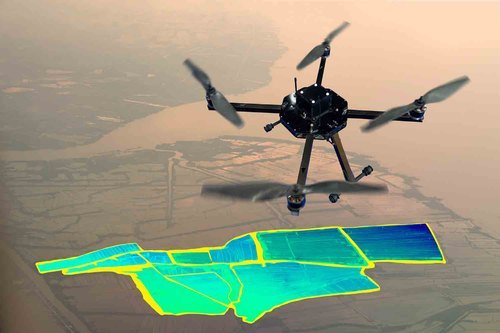
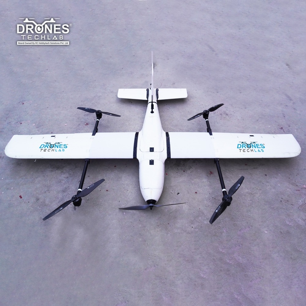
Designed for precise geospatial data capture, our Mapping & Surveying Drone combines high-resolution imaging with sub-centimeter LiDAR accuracy ideal for land mapping, infrastructure audits, and environmental assessments.
Mapping and surveying drones are advanced unmanned aerial vehicles (UAVs) equipped with high-resolution cameras, GPS, and LiDAR or photogrammetry sensors to capture accurate geographical data from the air. These drones are widely used in industries like construction, agriculture, mining, and urban planning for creating detailed topographic maps, 3D models, and land surveys. They significantly reduce the time, cost, and human effort involved in traditional surveying methods while delivering highly precise and real-time data for better decision-making. Our Mapping & Surveying Drone delivers high-precision data capture with its 50MP imaging, sub-centimeter LiDAR accuracy, and advanced GNSS navigation system. With 35 minutes of flight time, 5 km range, and a compact weatherproof design, it ensures reliable performance across land surveying, mapping, and industrial inspection missions.

Price:
Price 200000 INR / Piece
Minimum Order Quantity : 1 Piece
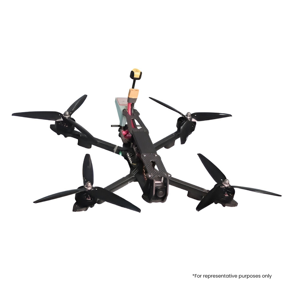
Technology : Other, Digital FPV Transmission, GPSassisted Flight, Smart Return to Home
Camera Type : Other, FPV Action Camera, WideAngle Lens
Sensor Type : Other, 6Axis Gyro, Accelerometer, Barometer, GPS/GLONASS module
Special Features : Other, GPS positioning, Altitude Hold, Long Range Transmission, Brushless Motors, Modular Battery, Return to Home (RTH), RealTime HD Video Transmission
Price 55000 INR / Piece
Minimum Order Quantity : 1 Piece
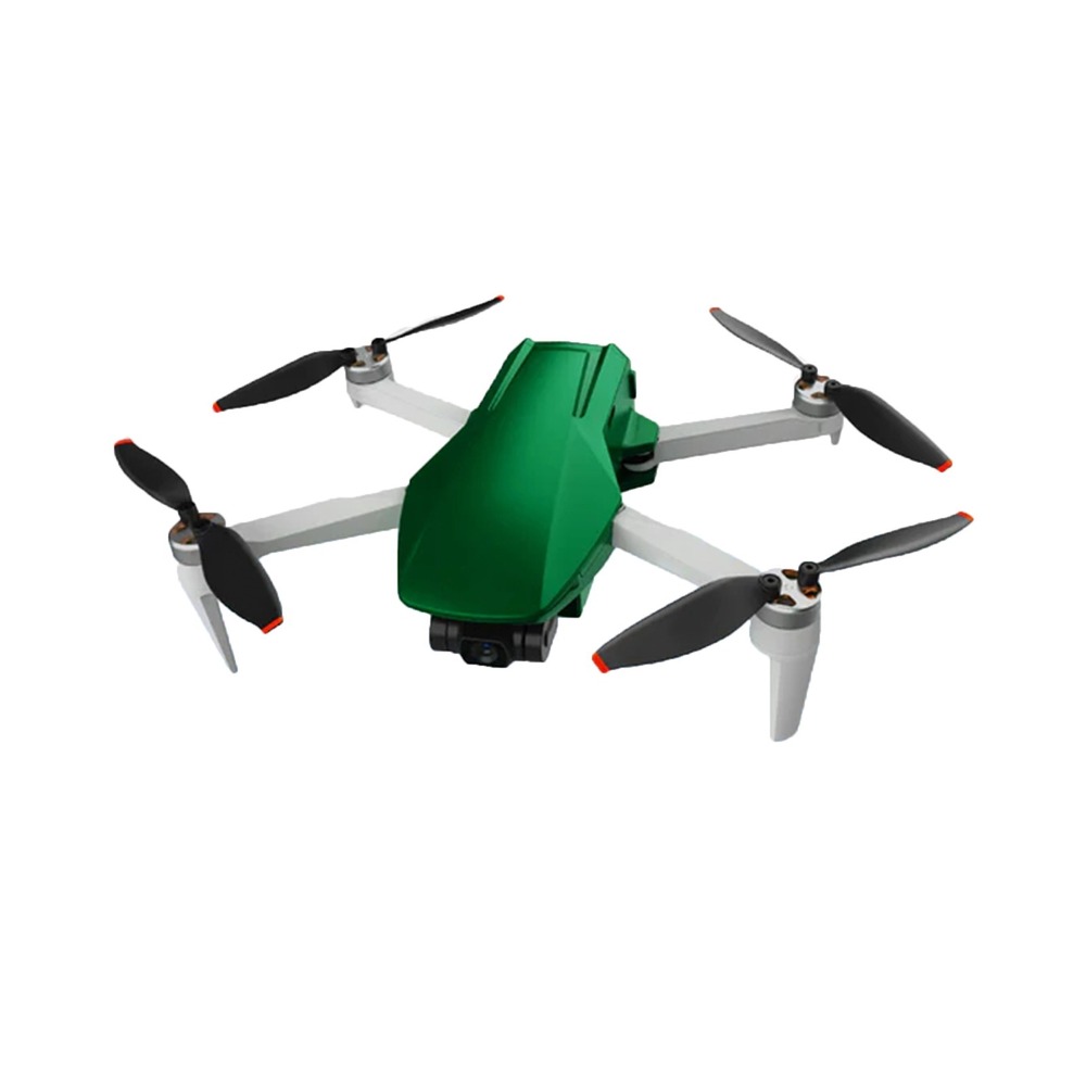
Technology : Other, Quadcopter, FPV (FirstPerson View), WiFi connectivity
Camera Type : Other, Wideangle lens digital camera
Sensor Type : Other, Gyroscope, accelerometer sensors
Special Features : Other, 360degree aerial view, altitude hold, headless mode, LED lights, onekey takeoff/landing, realtime video transmission
Price 95000 INR / Piece
Minimum Order Quantity : 1 Piece
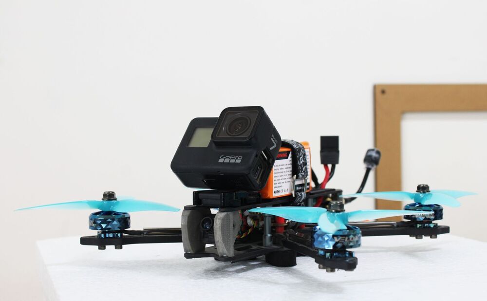
Technology : Other, FPV (First Person View), Realtime transmission, Advanced stabilization
Camera Type : Other, Digital FPV camera
Sensor Type : Other, Gyroscope, Accelerometer, GPS module
Special Features : Other, Foldable design, Lightweight body, Long battery life, Easy integration with smart devices
Price 800000 INR / Number
Minimum Order Quantity : 1 Number
Technology : Bluetooth
Camera Type : IP Camera
Sensor Type : CCD
Special Features : Weather Proof
GST : 19AAHCR7370L1ZP


 Send Inquiry
 English
 Spanish
 French
 German
 Italian
 Chinese (Simplified)
 Japanese
 Korean
 Arabic
 Portuguese