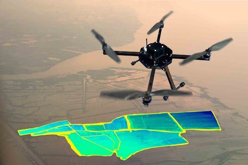
About Mapping And Surveying Drones
Designed for precise geospatial data capture, our Mapping & Surveying Drone combines high-resolution imaging with sub-centimeter LiDAR accuracy ideal for land mapping, infrastructure audits, and environmental assessments.
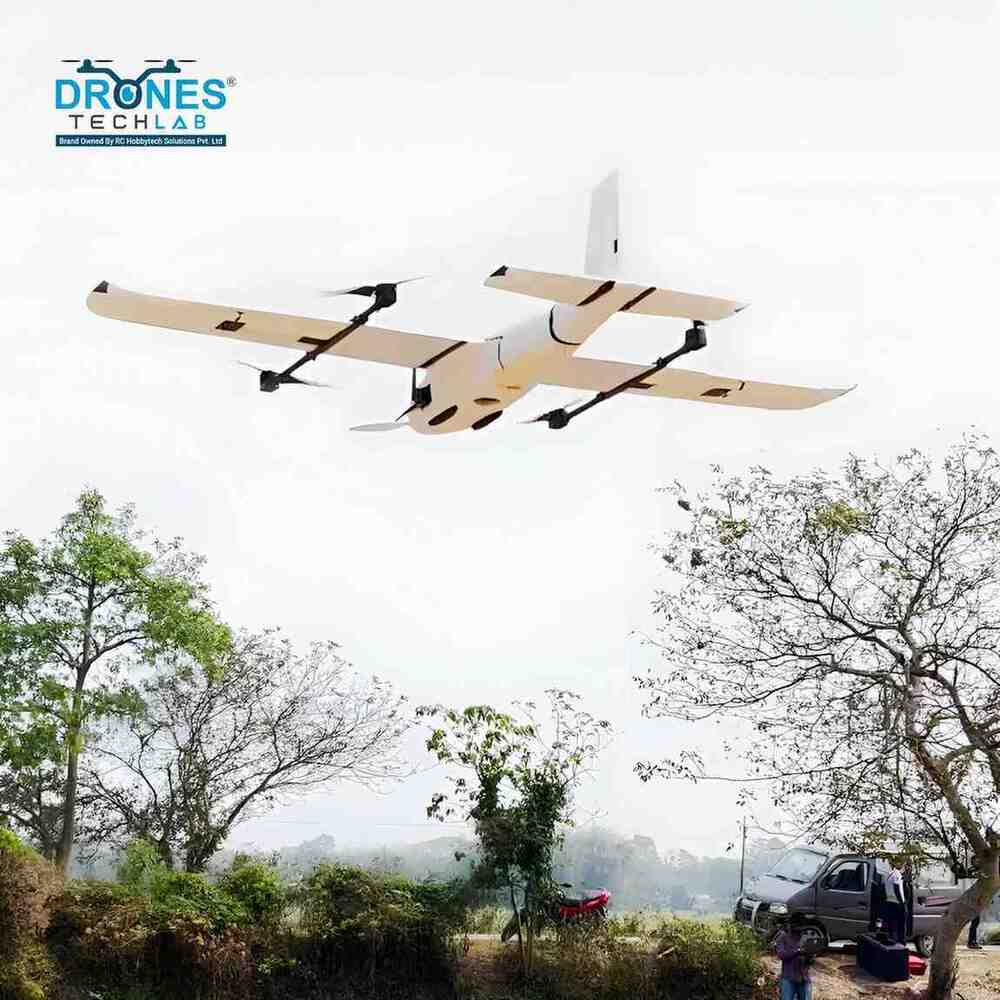
Mapping and surveying drones are advanced unmanned aerial vehicles (UAVs) equipped with high-resolution cameras, GPS, and LiDAR or photogrammetry sensors to capture accurate geographical data from the air. These drones are widely used in industries like construction, agriculture, mining, and urban planning for creating detailed topographic maps, 3D models, and land surveys. They significantly reduce the time, cost, and human effort involved in traditional surveying methods while delivering highly precise and real-time data for better decision-making. Our Mapping & Surveying Drone delivers high-precision data capture with its 50MP imaging, sub-centimeter LiDAR accuracy, and advanced GNSS navigation system. With 35 minutes of flight time, 5 km range, and a compact weatherproof design, it ensures reliable performance across land surveying, mapping, and industrial inspection missions.
Specifications ofMapping And Surveying Drones:
| Flight Time |
Up to 35 minutes per battery charge |
| Maximum Range |
Up to 5 kilometers |
| Payload Capacity |
Camera module optimized for mapping applications |
| GPS/GNSS Accuracy |
High-precision GNSS navigation system |
| Camera Resolution |
50 MP stills with up to 4K video output |
| LiDAR Capability |
Delivers sub-centimeter level accuracy |
| Flight Control System |
Integrated with operational authorization sensor |
| Fail-Safe Features |
Return-to-Home on signal loss, low battery, or mission completion |
| Portability |
Lightweight, compact form for field-ready deployment |
Notable Features:
- Combines photogrammetry and LiDAR for accurate terrain modeling
- Integrated fail-safe functions for secure autonomous operation
- Built for portability and quick setup across varied field environments
Precision Mapping for Industrial NeedsUnlock accurate land assessment and geospatial data collection with our Mapping and Surveying Drones. Built with advanced technology, these drones deliver high-resolution aerial imagery for construction, agriculture, and mining, streamlining decision-making and project execution.
Durable, Reliable, and Weather ProofDesigned to withstand harsh conditions, the drones weather proof metal body ensures reliable operation in rain, dust, and fluctuating temperatures. Its electric power supply supports consistent performance, making it suitable for outdoor industrial use year-round.
FAQs of Mapping And Surveying Drones:
Q: How does the Mapping and Surveying Drone operate in different weather conditions?
A: Thanks to its weather proof metal construction, the Mapping and Surveying Drone performs effectively in rain, dust, and varying temperatures, ensuring reliable results throughout the year.
Q: What industries can benefit from using this drone for mapping and surveying?
A: Industries such as construction, agriculture, mining, and infrastructure development can utilize this drone to achieve precise land mapping, monitoring, and geospatial analysis.
Q: When should industrial users opt for drone-based surveying over traditional methods?
A: Drones are ideal when rapid data collection, large area coverage, and frequent surveying are required. They offer significant time and cost savings compared to manual methods.
Q: Where is this drone manufactured and serviced?
A: The drone is manufactured and supported by a service provider based in India, ensuring accessible customer assistance and warranty coverage locally.
Q: What is the process of conducting a survey with this remote-controlled drone?
A: The survey process involves planning flight paths, deploying the drone with remote control, capturing aerial images and geospatial data, and then processing the collected information using specialized software.
Q: How can users maximize the benefits of the drones features?
A: By leveraging its weather proof design, electric power supply, and remote control, users can operate the drone in diverse environments and automate data collection, leading to higher efficiency and accuracy.


 Send Inquiry

 English
 Spanish
 French
 German
 Italian
 Chinese (Simplified)
 Japanese
 Korean
 Arabic
 Portuguese