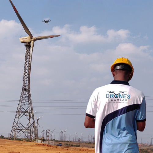
About Windmill inspection with drones
The inspection of the wind turbine and blade is challenging, because the structural problem could be very easily missed by the naked eye. This is where technology helps you to overcome challenges. Drones detect the structural damages, guiding through maintenance, increasing safety, and also helping in saving considerable costs.
Comprehensive Windmill InspectionsUtilizing high-end drones with both RGB and thermal imaging, our aerial surveys meticulously inspect windmill blades, towers, and nacelles. Supported by an AI-based damage classification system, each survey ensures detection of even subtle defects, enhancing both reliability and efficiency of your wind operations.
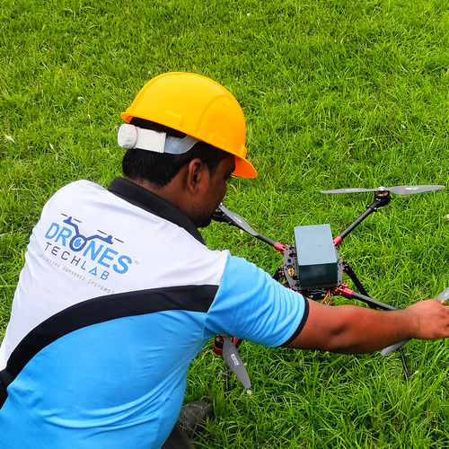
Robust and Reliable DeploymentDesigned for resilience, our drones operate effectively in light rain and up to 25 km/h winds. Each inspection is carried out by two certified operators and supported by real-time streaming and GPS-enabled flight planning, prioritizing safety and precision at operational altitudes up to 120 meters.
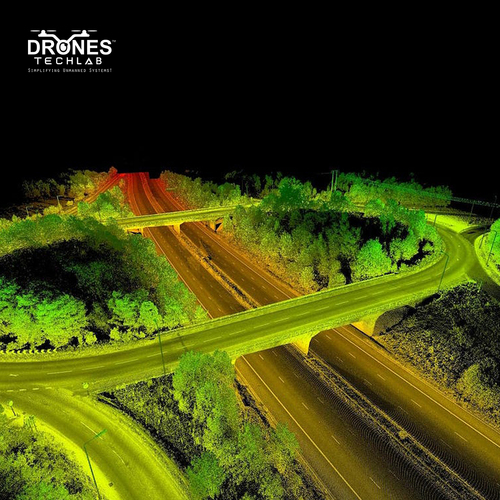
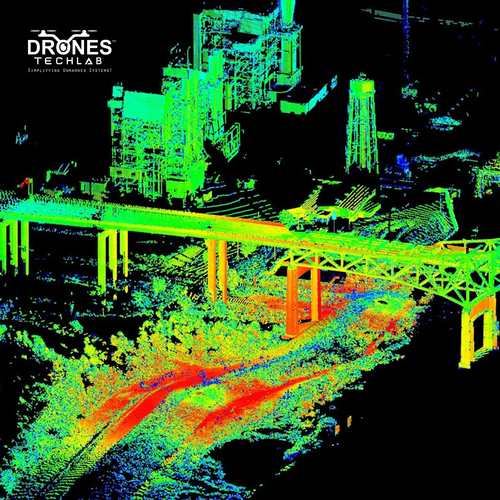
Secure, Actionable Data DeliveryInspection data, including HD imagery, 4K videos, and thermal maps, is securely encrypted and delivered via cloud or on-premise reporting. Our advanced analytics provide actionable insights within 24-48 hours, enabling timely maintenance decisions and minimizing windmill downtime.
FAQ's of Windmill inspection with drones:
Q: How is windmill inspection performed using your drone service?
A: Our inspection process involves deploying drones equipped with high-resolution RGB and thermal cameras to survey the windmill blades, towers, and nacelles. The drones conduct precise aerial assessments, guided by mission planning software and operated by two certified experts per mission.
Q: What specific areas of a windmill can your drones inspect?
A: Our drones meticulously inspect all critical windmill components, including blades, tower, and the nacelle, delivering high-definition and thermal imaging to identify potential defects or damages with millimeter-level accuracy.
Q: When will I receive the inspection data after the survey?
A: The processed inspection data, comprising HD images, 4K videos, and thermal analyses, is delivered securely via cloud or on-premise reporting within 24 to 48 hours after the onsite inspection is completed.
Q: Where are your inspection services available?
A: Our windmill drone inspection services are available pan-India and globally, ensuring coverage for both local and international wind farms.
Q: What technologies are used to ensure data security and accuracy?
A: We employ AES-256 encryption for all data transmissions and storage. Additionally, AI-based damage classification tools and high-resolution imaging enable highly accurate defect detection and reporting.
Q: How often do your drones require maintenance, and what safety features are included?
A: Each drone undergoes scheduled maintenance every 50 flight hours to ensure peak performance. Safety features include obstacle avoidance, GPS position hold, and certified operator oversight for secure operations.
Q: What are the main benefits of choosing drone-based windmill inspections?
A: Drone-based inspections are quicker, safer, and more cost-effective compared to manual methods. They minimize operational downtime, provide high-resolution actionable data, and enable rapid maintenance responses, enhancing the overall health and efficiency of wind assets.


 Send Inquiry

 English
 Spanish
 French
 German
 Italian
 Chinese (Simplified)
 Japanese
 Korean
 Arabic
 Portuguese