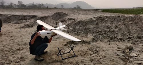
About Drone based mapping services
The GPS technology installed in the drones creates a digital representation of the data collected The cameras mounted on the top provide you with the perfect images This in turn helps the professional surveyors to build and execute a great number deliverables on time for their client
Sending out teams to dangerous areas or terrains can be lifethreatening Hence drones can be flown to scan difficult landscapes dangerous environments and ice locations thus creating a safer environment for all
It reduces costs by capturing data safely and faster
When done physically and manually a survey takes up lots of time With drones you do it within a fraction of second
Since drones are constantly recording and scanning innumerable measurements combining it with traditional data will yield accurate and precise data
Precision Mapping Across Multiple IndustriesOur drone mapping services provide unparalleled accuracy, supporting sectors like land surveying, agriculture, construction, and infrastructure inspection. With up to 2-5 cm accuracy and advanced imaging technology, clients receive dependable, detailed data for all project needs.
Comprehensive Support and CustomizationWe offer extensive technical assistance and customize mapping parameters based on client specifications. Our integration with major GIS & CAD software ensures seamless workflow, while regular drone maintenance and expert pilot operation guarantee optimal service quality.
Safety, Security, and Compliance AssuredOperating under DGCA regulations, we prioritize safety and maintain rigorous protocols. Your data remains protected with secure processing and storage. Liability insurance covers all fieldwork, so you can focus on results without concerns about operational risks.
FAQ's of Drone based mapping services:
Q: How does the drone mapping process work from start to finish?
A: Once a project is initiated, our certified pilots conduct an on-site survey using advanced drones fitted with high-resolution RGB and multispectral cameras. The captured data is securely processed to generate orthomosaic maps, 3D models, contour maps, or point clouds, which are then delivered digitally, typically within 2-7 days, depending on project size. Throughout the process, technical assistance is available and all operations adhere to DGCA safety regulations.
Q: What types of data outputs can I expect from the mapping service?
A: You will receive digital data outputs such as high-resolution orthomosaic maps, detailed 3D models, contour maps, and point clouds. These are compatible with major GIS and CAD software, supporting integration into your existing workflows or analysis tools.
Q: When is drone-based mapping most beneficial for my project?
A: Drone mapping is particularly advantageous when you require fast, accurate, and large-area surveys for applications such as land development, infrastructure inspections, agriculture monitoring, or construction planning. The service is highly suited for projects demanding precision data and quick turnaround times.
Q: Where can the drone mapping services be availed within India?
A: Our services are available pan India, covering projects in urban, rural, and remote locations. The drones are designed to operate in diverse weather conditions and different terrains, ensuring reliable results wherever your project is situated.
Q: What safety and compliance standards are followed during operations?
A: All drone mapping operations strictly adhere to DGCA (Directorate General of Civil Aviation) regulations and rigorous safety protocols. Furthermore, liability insurance covers on-field activities to protect project stakeholders from operational risks.
Q: Can mapping parameters and deliverables be customized to my project needs?
A: Yes, mapping parameters such as survey area, flight altitude, image resolution, and deliverable formats can be tailored according to your specific requirements. Our team collaborates with you to ensure the data output aligns with your project goals.
Q: What benefits do I get from choosing your drone mapping services?
A: Clients benefit from rapid data collection, exceptional mapping accuracy up to 2-5 cm, secure data handling, detailed reporting, and flexible support. Our certified GIS professionals and technicians ensure high-quality results with reliable maintenance and robust data security throughout each project.


 Send Inquiry


 English
 Spanish
 French
 German
 Italian
 Chinese (Simplified)
 Japanese
 Korean
 Arabic
 Portuguese