About Drone based survey
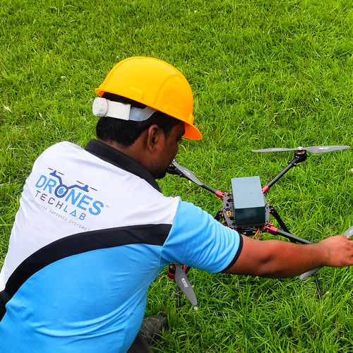
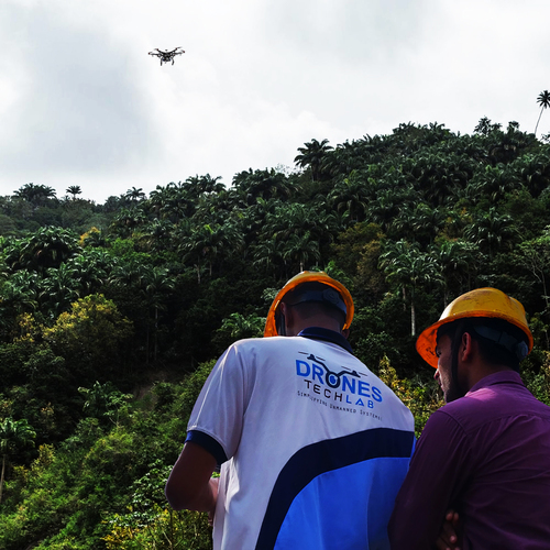
Experience the inestimable power of precision with our Drone Based Survey solutions, designed to set a new spotlight on land and agricultural mapping. With soaring speeds up to 15 m/s and fresh, encrypted data transmission, your surveys are completed faster and more securely. This lavish technology, packed with a 20 MP camera and advanced GPS/RTK navigation, delivers up to 2-5 cm accuracy and covers sprawling 100-hectare terrains per flight. Our unmatched service offers the best price, 24/7 support, professional user training, and compatibility with Pix4D, DroneDeploy, and Agisoft-making it the first choice for all major survey requirements in India.
Unmatched Features and Versatile Applications
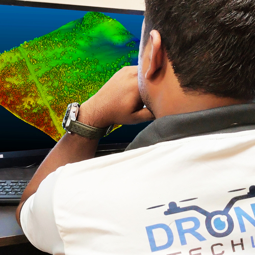
Our Drone Based Survey system delivers exceptional accuracy and efficiency for a wide spectrum of applications, including land and agricultural surveys, infrastructure inspection, and complex mapping projects. Utilizing a 20 MP camera, GPS/RTK-enabled navigation, and strong wind resistance, it effortlessly surveys large areas such as farmland, construction sites, and urban developments with consistent quality. Whether you need detailed orthomosaics, DEMs, or 3D models, this solution supports precise plant and ground surface analysis for in-depth insights.
Swift Shipment and Global Market Reach
Delivery time for our Drone Based Survey solutions varies by order size but is consistently prompt to meet soaring demands. Our robust shipment process ensures secure, timely arrival of shipped goods whether for domestic projects in India or export to international clients. Comprehensive samples are available to demonstrate product excellence. We take pride in delivering lavish, fresh technology to various markets across the globe, making each delivery a testament to our commitment to quality and reliability.
FAQ's of Drone based survey:
Q: How accurate are the surveys conducted using the Drone Based Survey system?
A: The Drone Based Survey system offers survey precision with an accuracy range of 2-5 cm, especially when utilizing RTK/GNSS positioning technology, ensuring high reliability for critical surveying tasks.
Q: What is the maximum area that can be covered per drone flight?
A: Each flight can cover approximately 100 hectares, depending on conditions and payload, making it suitable for large-scale land, agriculture, and infrastructure survey projects.
Q: When is user training provided for this drone survey service?
A: User training is available upon request to ensure optimal usage and complete understanding of the features, data processing, and safe operation of the drone survey system.
Q: What applications can benefit most from this drone-based survey solution?
A: Land surveyors, agricultural consultants, infrastructure inspection teams, and mapping professionals can gain inestimable insights using the drone for tasks like orthomosaic generation, 3D modeling, and contour mapping.
Q: How is data security managed during drone-based surveys?
A: The system ensures data security through encrypted data transmission and options for cloud upload as well as secure SD card storage, safeguarding sensitive survey information.
Q: Where can the product be shipped, and sample demonstrations arranged?
A: The Drone Based Survey solution can be shipped domestically across India and exported to international markets. Samples and product demonstrations are available on request.


 Send Inquiry


 English
 Spanish
 French
 German
 Italian
 Chinese (Simplified)
 Japanese
 Korean
 Arabic
 Portuguese