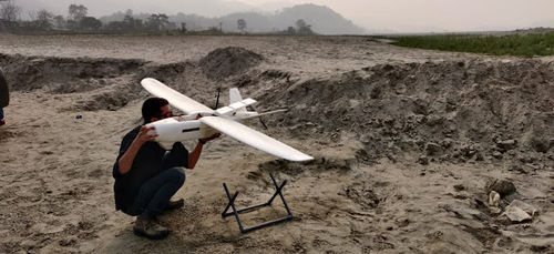
About Drone Surveying
Drone-based surveys offer unparalleled efficiency and precision in data collection across various industries. By leveraging advanced aerial technology, these surveys provide comprehensive insights into terrain features, infrastructure, and environmental conditions. From topographical mapping to infrastructure inspection, drone-based surveys revolutionize data-gathering processes, enhancing decision-making and project management capabilities. Through advanced aerial technology, we offer:
Topographical Mapping: Generate accurate digital elevation models (DEMs) and topographic maps to analyze terrain features and contours.
Orthomosaic Mapping: Stitch together multiple aerial images to create seamless, georeferenced maps with uniform scale and resolution.
Aerial Imagery: Capture high-resolution images from above, providing a comprehensive view of the survey area.
3D Modeling: Create detailed three-dimensional models of landscapes, structures, or infrastructure for precise measurements and analysis.
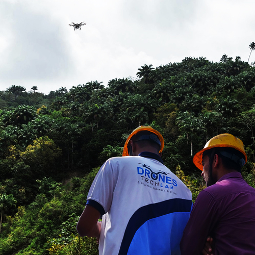
Vegetation Analysis: Assess vegetation health, density, and coverage using specialized sensors to monitor agricultural fields, forests, or natural habitats.
Thermal Imaging: Utilize thermal cameras to detect temperature variations and identify anomalies in infrastructure, such as heat leaks or electrical hotspots.
Environmental Monitoring: Monitor environmental parameters like water quality, pollution levels, or habitat changes to support conservation efforts or regulatory compliance.
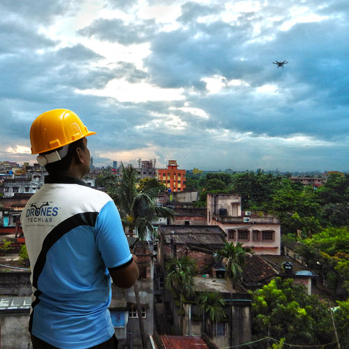
Construction Progress Tracking: Monitor construction sites to track progress, identify potential issues, and ensure adherence to project timelines.
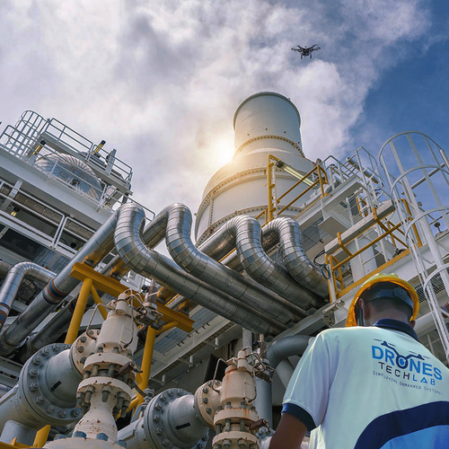
Infrastructure Inspection: Conduct visual inspections of infrastructure assets such as bridges, pipelines, or power lines to detect defects or maintenance needs.
Hazard Assessment: Identify potential hazards or safety risks in industrial or hazardous environments, minimizing human exposure and improving safety protocols.
Experience unparalleled precision, efficiency, and safety in data collection and analysis with our drone-based survey solutions.
Efficient and Accurate SurveyingWith seamless integration of autopilot systems and GPS/RTK technology, Drone Surveying offers high-accuracy mapping and inspection-delivering results within centimeters precision. Its capability to provide real-time video feeds and rapid coverage across large areas ensures that projects are completed promptly without compromising on quality or detail.
Comprehensive Data Collection and ProcessingThe system supports multiple image formats (JPEG, RAW), and outputs deliverables like orthomosaic maps, DEMs, and contour maps. GIS compatibility allows integration into existing workflows, while dedicated post-processing software streamlines data analysis and reporting.
Onsite Support and TrainingUsers receive hands-on training and on-call technical assistance for maintenance to ensure safe, uninterrupted operation of surveying missions. This service-focused approach underpins reliability and user confidence throughout project implementation.
FAQ's of Drone Surveying:
Q: How does Drone Surveying improve the efficiency of land and infrastructure surveys?
A: Drone Surveying leverages autopilot with GPS/RTK, allowing automated flight paths, real-time video monitoring, and high-resolution imagery collection. This drastically reduces survey completion times, enhances precision, and minimizes human error, making it much more efficient than traditional land surveying methods.
Q: What types of deliverables can clients expect from a typical drone survey?
A: Clients receive detailed orthomosaic maps, 3D terrain models, digital surface models (DEM), contour maps, and GIS-compatible data files. Tailored survey reports and mapped imagery are provided in line with project requirements, ensuring actionable insights for construction, agriculture, or infrastructure inspection.
Q: When is post-processing required, and is the necessary software included?
A: Post-processing is typically needed to convert raw data into accurate maps and 3D models. Suitable post-processing software is recommended or provided based on client requirements, streamlining the transformation of field data into deliverables for analysis or integration within GIS systems.
Q: Where can the Drone Surveying service be deployed, and what are its range limitations?
A: Drone Surveying is available across India and can operate in diverse environments where the minimum survey area is 1 acre. The drones have a range of up to 5 km and can fly up to 400 ft AGL, subject to local aviation regulations and specific drone models.
Q: What is the typical workflow for conducting a drone survey?
A: The process begins with mission planning and area mapping, followed by onsite drone deployment equipped with GPS/RTK. Data is captured via high-resolution cameras, transmitted through a live video feed, and then processed using specialized software. Final deliverables are compiled and delivered as survey reports and digital maps.
Q: How does drone technology benefit projects in mapping and construction industries?
A: The integration of GPS, RTK, and photogrammetry ensures highly accurate measurements, efficient data collection, and rapid turnaround. This facilitates improved project planning, progress monitoring, and quality control for construction, mapping, and infrastructure sectors.
Q: Is user training and on-call maintenance support available?
A: Yes, comprehensive user training is provided to ensure safe and effective operation of the drone surveying system. Additionally, on-call assistance is available for maintenance support, helping users address technical issues promptly and minimize downtime during surveying operations.


 Send Inquiry

 Call Me Free
 English
 Spanish
 French
 German
 Italian
 Chinese (Simplified)
 Japanese
 Korean
 Arabic
 Portuguese