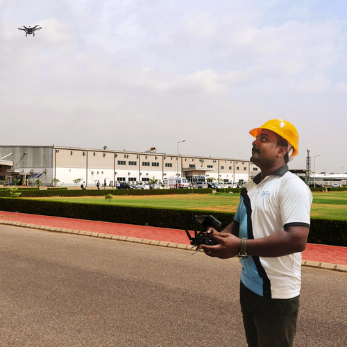
About LiDAR-based Road Survey
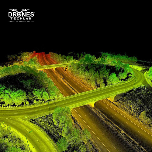
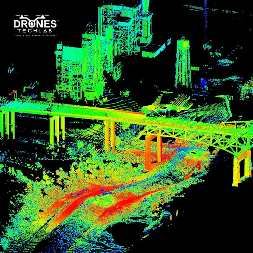
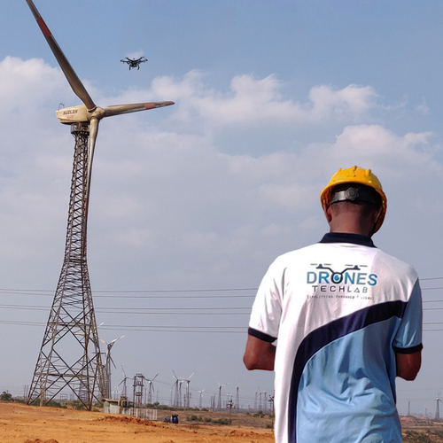
LiDAR-based Road Survey using Drones is used to collect highly detailed and accurate data about road infrastructure and terrain. This technology measures the distance between the drone and the ground to create precise 3D maps of roads and surrounding areas. LiDAR technology provides highly accurate measurements, allowing for detailed mapping of road surfaces and features. Drones equipped with LiDAR sensors can cover large areas quickly, reducing surveying time and costs. By reducing the need for manual surveying, LiDAR-based Road Surveys using Drones can improve safety for surveyors and road workers. The detailed 3D maps generated by LiDAR Survey can be used for detailed analysis of road conditions, pavement quality, and infrastructure planning. LiDAR-based Road Surveys can help minimize environmental impact by reducing the need for ground vehicles and personnel.
Advanced Mobile LiDAR Technology for Precision Road SurveysEquipped with LiDAR sensors and GNSS/IMU integration, this solution captures high-accuracy 3D mapping data with up to 2 cm precision. Its mobile, vehicle-mounted operation allows rapid and consistent surveying on highways and urban roads, regardless of weather or lighting conditions.
Versatile Data Output and Seamless IntegrationSurvey data is provided in standard formats such as LAS and LAZ, as well as additional industry-standard outputs. The system can integrate effortlessly with existing GIS software, expediting analysis and streamlining road infrastructure management workflows.
Real-Time Insights and Scalable StorageReal-time visualization empowers teams to make informed on-site decisions. The solution's expandable storage (up to 4 TB) ensures ample capacity for large-scale projects, while automated processing enhances operational efficiency.
FAQ's of LiDAR-based Road Survey:
Q: How does the LiDAR-based road survey system operate in different environments?
A: The system is designed to function reliably in a variety of weather and lighting conditions, making it ideal for both urban and highway environments. Its environmental adaptability ensures consistent, precise data capture at survey speeds up to 100 km/h.
Q: What types of data formats are supported for output?
A: The surveyed data is available in widely used industry-standard formats like LAS and LAZ, along with other commonly used formats. This ensures easy integration into existing GIS platforms for road infrastructure management.
Q: When is real-time visualization available during the survey process?
A: Real-time visualization is available throughout the survey, enabling field teams to view 3D point clouds and mapping results on site. This feature supports swift decision-making and immediate quality assurance.
Q: Where can this LiDAR-based survey system be deployed?
A: This mobile solution can be deployed across India on a variety of road networks, including highways and urban roads. Its long-range capability and mobile design make it suitable for diverse infrastructure projects.
Q: What is the process for conducting a survey using this technology?
A: The process involves mounting the LiDAR-based system onto a survey vehicle, configuring data requirements, and conducting the survey at permissible speeds. Data is collected and processed automatically, generating high-resolution 3D maps and point clouds.
Q: How does integrating with existing GIS systems benefit road infrastructure analysis?
A: Seamless compatibility with GIS platforms allows for immediate incorporation of accurate, detailed survey data into existing workflows, improving planning, maintenance scheduling, and infrastructure decision-making.
Q: What kind of support is available for operation and troubleshooting?
A: Both on-site and remote technical support are provided within India, ensuring optimal system performance, troubleshooting assistance, and training as needed.


 Send Inquiry
 Call Me Free
 English
 Spanish
 French
 German
 Italian
 Chinese (Simplified)
 Japanese
 Korean
 Arabic
 Portuguese