LiDAR Based UAV Mapping
LiDAR Based UAV Mapping Specification
- Product Type
- Mapping Equipment
- Power Source
- Electric
- Use
- Industrial
- Product Name
- LiDAR Based UAV Mapping
LiDAR Based UAV Mapping Trade Information
- Sample Available
- Yes
- Sample Policy
- Free samples are available
- Main Export Market(s)
- Asia
- Main Domestic Market
- All India
About LiDAR Based UAV Mapping
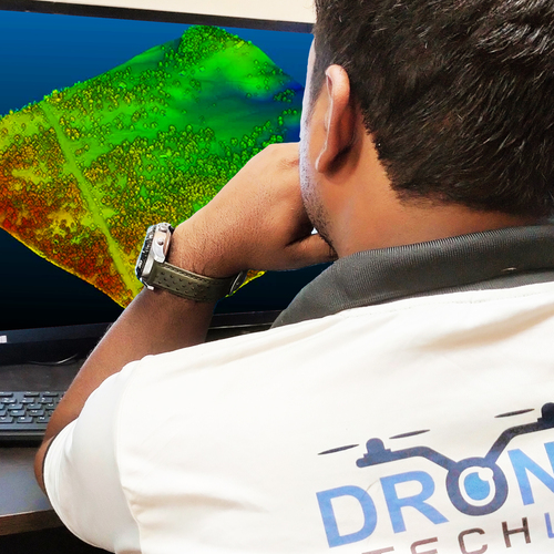
It is time to change your game plan of working things out in your organization. With UAV LiDAR mapping, you can get down to every minute detail, seeping through even foliage and brush. Used since the 1960s, it is the most accurate form to create models of digital elevation. Some forms can also be used to map terrain such as shallow lakes and riverbeds.
The mapping technology uses laser light of multiple pulses to determine the distance between the object and sensor. The light pulses travel extraordinarily quickly, while the sensors use the amount of time that these pulses take to be bounced back to find out how far the object is. Used in conjunction with advanced technology, LiDAR uses software solutions to determine the type of object, in addition to just elevation.A
In addition to recording elevations, this technology can also be used to accurately identify things such as power lines, street lamps and even birds. They are also known to find out the difference between things such as one that is natural, or one that is man-made. This technology has found its uses in archaeology, geology, agriculture, and even law enforcement.


Price:
- 50
- 100
- 200
- 250
- 500
- 1000+

 Send Inquiry


 Call Me Free
 English
 Spanish
 French
 German
 Italian
 Chinese (Simplified)
 Japanese
 Korean
 Arabic
 Portuguese