About Gis and mapping service with drones
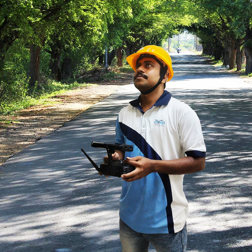
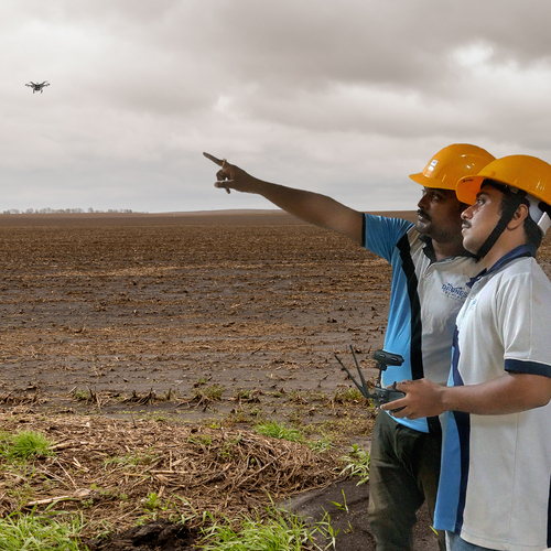
Drones are Unmanned Aerial Vehicles that are remotely piloted by efficient and well-trained pilots to do surveying and mapping, and have potential civil and professional usages. Right from creating a general survey of the area to creating a detailed database of each and every square foot, drones make the mapping service faster, easier and safer for surveyors. This in turns removes the hurdles that are faced while doing physical surveys that results in consuming more manpower, efforts and time. Also, most of the time they are often prone to errors too. All of these issues which you might not find with Unmanned Aerial Vehicles or Drones.
Perform advanced analysis with a wide range of tools, and thus sharing your imagery outputs within the organization or your clients.
Capture reality with drones as and when you require it for conducting your GIS drone mapping workflow. After collecting the drone data you create your database to process your 2D and 3D outputs.
Drone analytics with 2D and 3D outputs helps you to make measurements, perform other analyses, and track changes
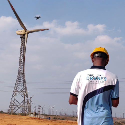
Comprehensive GIS Mapping Across IndiaOur GIS mapping service covers the entire Indian region, offering industrial clients a scalable, reliable solution for terrain analysis, infrastructure surveys, and asset management. Using multirotor and fixed wing drones, we efficiently map expansive areas while maintaining high accuracy, supporting diverse applications from resource management to urban planning.
Advanced Sensor Integration for Precise DataWe integrate RGB and multispectral sensors, with LiDAR available as an option, enabling multifaceted data capture. This sensor suite, combined with up to 20 MP camera resolution and high image overlap, allows us to generate precise orthomosaics, detailed point clouds, and 3D models, all tailored to your project requirements.
Fast and Secure Processing and DeliveryAll data is transferred securely with encryption and processed using industry-leading software, either in the cloud or locally, based on client preferences. Map updates are available on request, and digital deliverables are provided within a guaranteed timeframe of 3-7 days, supporting time-sensitive business operations.
FAQ's of Gis and mapping service with drones:
Q: How does your drone-based GIS mapping service work?
A: We deploy certified drone pilots equipped with multirotor or fixed wing drones to survey your specified region. The drones capture high-resolution images using RGB, multispectral, or LiDAR sensors, which are then processed with Pix4D, DroneDeploy, or Agisoft Metashape to produce accurate maps and 3D models.
Q: What types of data outputs can I expect from your service?
A: Depending on your requirements, we deliver outputs such as orthomosaics, point clouds, 3D models, and DSM/DEM files. All deliverables are supplied digitally and can integrate seamlessly into your GIS or CAD workflows.
Q: When will I receive the processed mapping data after a drone survey?
A: Processed data is typically delivered within 3 to 7 days of completing the aerial survey, ensuring a quick turnaround for planning or analysis needs.
Q: Where is your drone GIS mapping service available?
A: Our service operates pan-India and is available across all regions, including remote areas, supporting a broad range of industries such as infrastructure, mining, and agriculture.
Q: What measures are taken to ensure data security and integrity?
A: We ensure all data transfers are encrypted, maintaining strict security protocols from the point of data capture through delivery. Processing can be performed either in the cloud or locally, based on your security requirements.
Q: How accurate is the mapping data provided by your service?
A: Our mapping solutions deliver high-precision results, with ground sampling distance (GSD) accuracy of up to 2-5 centimeters, suitable for detailed industrial and survey applications.
Q: What are the main benefits of using drone-based GIS mapping for industrial projects?
A: Drone-based GIS mapping offers large area coverage, real-time data collection, and high accuracy while reducing survey times and costs. This approach supports more informed decision-making and efficient resource management for industrial projects.


 Send Inquiry


 Call Me Free
 English
 Spanish
 French
 German
 Italian
 Chinese (Simplified)
 Japanese
 Korean
 Arabic
 Portuguese