About Mapping with RTK and PPK drones
Type- Automapper
Site Location- Pan India
Mobile Accessible- yes
Features- Accurate, autonomous
UAV- DJI Parrot
2D-3D Map- Yes
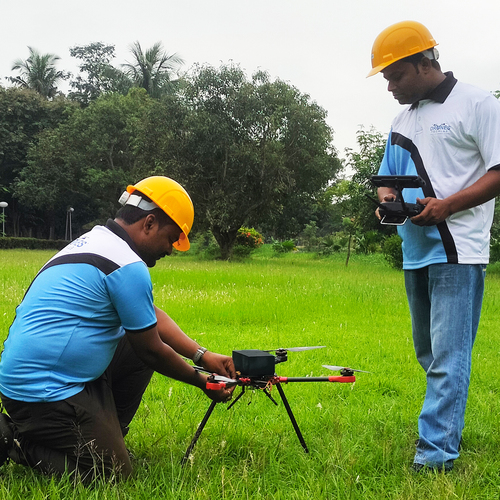
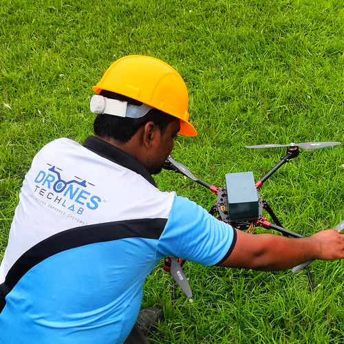
Drones are extensively being used nowadays for their accuracy and precision for any mapping, surveying and for surveillance. To get location information the GPS is enabled, and Real Time Kinetic also known as RTK and Post Processing Kinematic also known as PPK are the two emerging developing methods.
RTK is the process of correcting location errors when the drones are flying, while PPK is applying correction after the flight. These are important because a drone without the ability to record accurate information is just a simple flying machine with a camera on it. You can get excellent images and videos, but this can not be used for surveillance, mapping or for surveying purposes. Since Drones are being used for bigger and crucial projects, accuracy, efficiency and time becomes paramount.
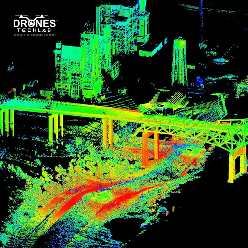
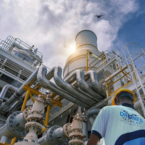
Achieve Exceptional Accuracy with RTK/PPK DronesUnlock the next level of survey-grade mapping across construction sites, agricultural lands, and topographic projects with RTK and PPK drone technology. Designed for centimeter-level precision, these drones minimize or even eliminate the need for traditional Ground Control Points (GCPs). When paired with high image overlap and sub-centimeter resolution sensors, your spatial datasets reach unmatched detail and reliability, supporting confident decision-making in your field.
Seamless Integration with GIS and CAD WorkflowsExport and utilize mapping outputs efficiently with ready compatibility for popular GIS and CAD software. Whether you're overlaying orthomosaics, generating digital elevation models, or drafting site plans, our RTK/PPK mapping solutions ensure smooth data imports and streamlined workflows. This effortless integration supports a full spectrum of land management, planning, and design tasks for diverse industries.
Flexible RTK Correction Sources for Every ProjectAdapt to any terrain or project scale with multiple RTK correction options. Use a dedicated base station, access a trusted CORS network, or connect via NTRIP, maximizing coverage and on-site flexibility. Full PPK post-processing capabilities mean you retain precision even in challenging environments or remote sites, making reliable, high-accuracy mapping accessible anywhere in India.
FAQ's of Mapping with RTK and PPK drones:
Q: How does using RTK/PPK drones reduce the need for Ground Control Points (GCPs)?
A: By leveraging real-time or post-processed kinematic corrections, RTK and PPK drones achieve precise georeferencing with few or no GCPs. This dramatically streamlines fieldwork, saving time while maintaining centimeter-level mapping accuracy.
Q: What types of projects benefit from high-precision RTK/PPK drone mapping?
A: Projects in surveying, construction, agriculture, and GIS-including topographic mapping and site planning-greatly benefit from RTK/PPK precision. These drones deliver detailed results and facilitate data integration for diverse applications.
Q: When is it necessary to use a particular RTK correction source like Base Station, CORS, or NTRIP?
A: A base station is ideal for localized projects, while CORS and NTRIP networks offer convenience and broader coverage in areas where local base stations are unavailable. The choice depends on site conditions, accuracy requirements, and network accessibility.
Q: Where can the data collected by these drones be used?
A: The mapped datasets are fully compatible with popular GIS and CAD software, enabling use in cartography, spatial analysis, land development, infrastructure design, and agricultural management across multiple industries.
Q: What is the image resolution capability of these RTK/PPK drones?
A: Thanks to advanced camera payloads, these drones can capture images with resolutions down to the sub-centimeter level. This enables highly detailed mapping, supporting applications that require fine spatial detail.
Q: How does the high image overlap feature improve mapping results?
A: High overlap during image capture ensures robust data for photogrammetric processing, yielding more accurate 3D models, orthomosaics, and topographic outputs. It also enhances consistency and reduces errors in final maps.
Q: What support is available for post-processing with PPK workflows?
A: The drones come with full post-processing support, allowing users to refine positioning data after the flight. This ensures maximum accuracy and flexibility, particularly for projects where real-time corrections may be limited.


 Send Inquiry
 Call Me Free
 English
 Spanish
 French
 German
 Italian
 Chinese (Simplified)
 Japanese
 Korean
 Arabic
 Portuguese