About Forest monitoring service using drones
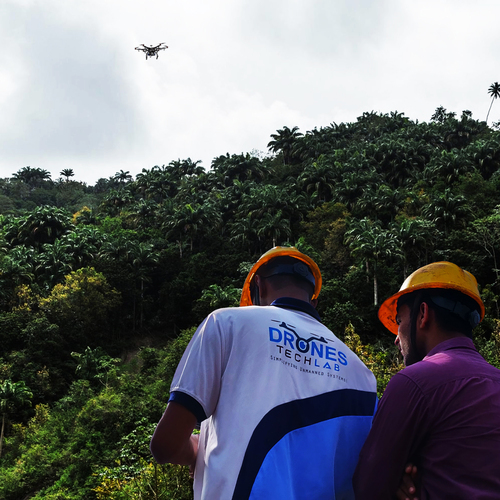
Capitalise on peerless forest monitoring capabilities with our venerable drone service, engineered for rapid response and powered by formidable imaging technology. Advance Purchase offers clients the opportunity to spotlight environmental protection, biodiversity assessment, and forest surveillance, all underpinned by expert operations from certified drone pilots and analysts. Supporting both fixed-wing and multi-rotor drones with up to 90 minutes' battery life, our service is uniquely customized to terrain and objectives. Data integrates seamlessly with GIS and remote sensing platforms, ensuring automated reporting, real-time analytics, and robust storage solutions-making us the leading manufacturer and service provider in India.
Innovative Plant Applications and Service Features
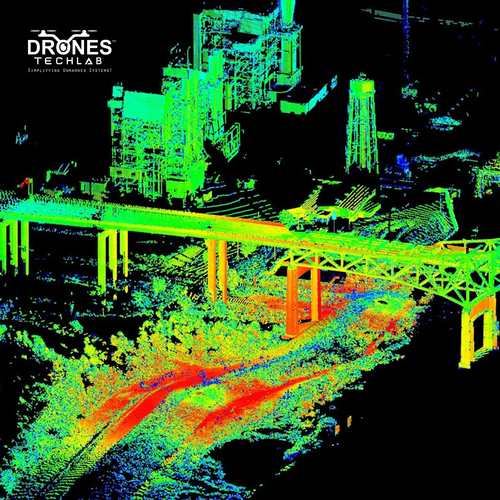
Our forest monitoring drones unleash significant advantages for plant management. Benefiting from advanced imaging technologies-high-resolution, infrared, and multispectral-clients receive accurate tree health assessments and actionable biodiversity insights. Customizable flight paths and surveys are fine-tuned to forest size and terrain, allowing precise environmental protection. Rapid deployment, real-time data capture, and automated analytics make this service indispensable for detailed forest surveillance and sustainable management.
Packaging, Payment, and Export Details
Each monitoring package is responsibly dispatched with secure drone and accessory packaging, ensuring safe arrival. Payment terms are flexible and transparent, tailored to accommodate client requirements, with the asking price presented upfront for clarity. We export primarily to leading markets in Asia, Europe, and Africa, providing comprehensive after-sales and maintenance support. Clients can expect reliable technical assistance, prompt delivery, and competitive pricing aligned with industry standards.
FAQ's of Forest monitoring service using drones:
Q: How does the drone-based forest monitoring service operate?
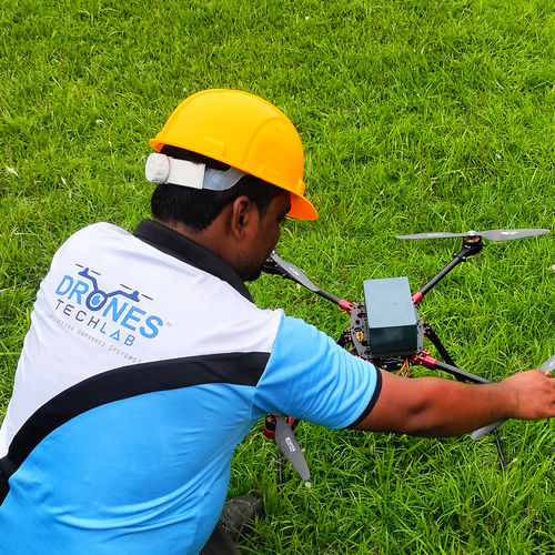
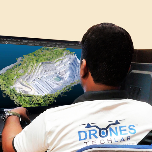
A: The service utilizes certified pilots and environmental analysts to deploy fixed-wing and multi-rotor drones. These drones capture real-time aerial imagery and analytics using high-resolution cameras, with data integrated into GIS and remote sensing platforms for comprehensive forest assessment.
Q: What are the primary plant and environmental applications of this service?
A: Our drones provide detailed tree health assessment, biodiversity analysis, illegal logging detection, and fire monitoring. These applications support effective forest management, conservation efforts, and environmental protection strategies.
Q: When can clients expect data reports and analytics after a survey?
A: Automated report generation and data analysis are completed promptly after each survey, delivering results within hours depending on forest size and complexity. Clients benefit from rapid access to actionable insights.
Q: Where is the service available and what regions do you export to?
A: We offer our forest monitoring service throughout India and export to major markets across Asia, Europe, and Africa, delivering secure packaging and maintenance support worldwide.
Q: What process is followed for customizing forest surveys?
A: Each project is tailored to the client's forest size, terrain, and specific monitoring requirements. Our team collaborates closely with clients to determine the best drone type, flight path, and data capture approach for optimal results.
Q: How does the service benefit forest management and surveillance?
A: Clients gain peerless, real-time intelligence for proactive forest health management, rapid illegal activity detection, and enhanced biodiversity assessment, empowering sustainable and responsible forestry practices.


 Send Inquiry
 English
 Spanish
 French
 German
 Italian
 Chinese (Simplified)
 Japanese
 Korean
 Arabic
 Portuguese