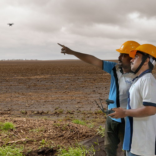
About Soil erosion mapping
About 68.4% of total eroded soil gets affected by rainfall and water-driven erosion. Parts of Assam and Meghalaya are the most affected areas in India. This does not mean though that other parts of India are not vulnerable to rainfall-driven soil erosion. With changes in the climate, most parts of the country are witnessing extreme rainfall events.
Hence the need for an accurate rainfall erosivity map. This will help the watershed managers to plan, prioritize and implement the required development activities to minimize soil erosion. Developmental activities such as plantations, drainage line treatments, continuous contour trenches etc
Accurate Visualization for Informed Decision-MakingSoil Erosion Mapping provides a comprehensive view of soil degradation, allowing users to easily distinguish between low, medium, and high erosion zones. The multi-color scheme and clear legend facilitate quick understanding, making these maps essential for planning interventions and prioritizing conservation efforts.
Flexible Map Formats to Suit Every NeedUsers can request the Soil Erosion Mapping product in printed or soft copy formats, ensuring convenience and adaptability for various project requirements. Whether for fieldwork or presentations, the map format caters to both on-site researchers and policy-makers in offices.
Supports Multiple Land Management ApplicationsDesigned for researchers, government agencies, and consultancies, these maps serve diverse purposes-ranging from agricultural planning to environmental conservation. Their thematic focus helps in developing targeted strategies, allocating resources efficiently, and promoting sustainable practices.
FAQ's of Soil erosion mapping:
Q: How is the soil erosion mapping data presented on the map?
A: The data is presented thematically with three color-coded zones denoting low, medium, and high soil erosion levels. A legend is included, making it easy to interpret these visual distinctions.
Q: What is the process for obtaining a printed or soft copy of the Soil Erosion Mapping?
A: You can specify your preferred format-printed or digital (soft copy)-while placing your order. The map will be delivered in the selected format, ensuring it meets your particular project or institutional requirements.
Q: When should soil erosion maps be used in land management?
A: Soil erosion maps should be utilized during the planning and evaluation stages of land management, agricultural development, and conservation studies. They are particularly beneficial before launching interventions or projects to identify and address at-risk areas.
Q: Where are these maps most applicable?
A: These maps are suitable for diverse locations across India, especially where soil erosion is a concern-agricultural lands, watersheds, forested areas, and regions undergoing rapid development all benefit from erosion mapping.
Q: What are the main benefits of using soil erosion mapping for researchers and agencies?
A: The main benefits include enabling targeted soil conservation, improving agricultural planning, supporting data-driven policy-making, and facilitating efficient resource allocation for land management interventions.
Q: How can the maps be used for soil conservation studies and agricultural planning?
A: By identifying zones with varying soil erosion intensities, users can prioritize conservation strategies, devise crop management plans, and implement measures tailored to specific erosion risks.
Q: Who provides the Soil Erosion Mapping service in India?
A: The maps are provided by a dedicated manufacturer and service provider in India, specializing in thematic environmental mapping for professional and institutional use.


 Send Inquiry


 Call Me Free
 English
 Spanish
 French
 German
 Italian
 Chinese (Simplified)
 Japanese
 Korean
 Arabic
 Portuguese